
Architect Designs for an In-Town Country Place
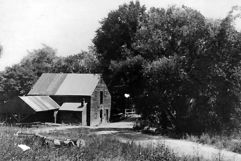
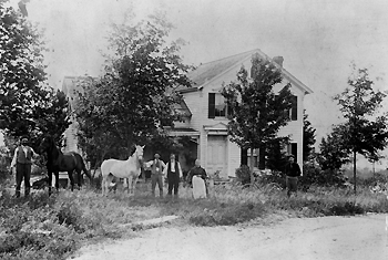
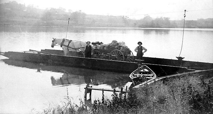
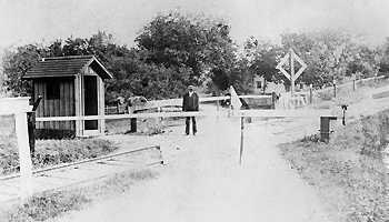
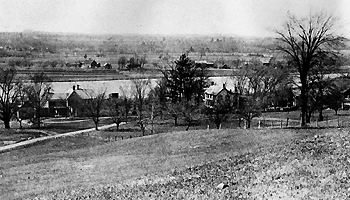
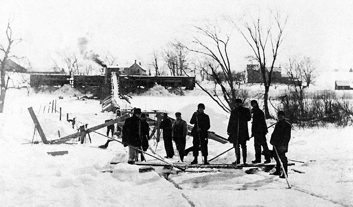
HistoryTen to fifteen thousand years ago the continental glaciers began to recede from this area leaving an esker. This covered Shaker Bay with a variety of sediments, from the gravel mined by the Town from the pits behind it, to the fine sands in the front part mined in the eighteen hundreds by the White Company for molding sand. As the climate warmed, forests grew, mastodons roamed the area and Indians came north. Shaker Creek which runs under River Road a tenth of a mile west of Shaker Bay was the site of an Indian settlement. They took advantage of the river for fishing and transportation and the rich alluvial flats for crops. During the French and Indian Wars it was the site of the "Mohawk Niskayuna Fort". In the eighteen hundreds it was the site of the Shaker Saw and Grist Mill and one of their broom factories. Prior to the flooding of much of their flatlands and islands for the barge canal they used this area to grow broom corn. The Shakers invented the flat broom, the circular saw and developed and marketed many varieties of seeds and herbs. The Fort family lived at the bend of Fort's Ferry Road opposite the Southwest corner of Shaker Bay. They operated the railway crossing and the Ferry which attached to a cable by pulleys and used the current to drive it across. The Ferry ran from the present Fire Dept. launch site to the road which now runs through the Nature and Historic Preserve crossing the old Erie Canal bed over the truss bridge. In 1840 the City of Troy, not to be outdone by Albany, built their own railway line to Schenectady which is now the bicycle path. Shown below are the Shaker Saw and Grist Mill, the Fort House, Fort's Ferry, the railway crossing (now Fort's Ferry Road and the bicycle path), and a view from lot 9 of the two Onderdonk family homes known as "O'Sunset Farms" owing to the spectacular view over the river at dusk. At the bottom, the Onderdonks are loading ice from the river onto railway cars (Shaker Bay and the homes in the previous picture are shown in the background). |
|
|
|
|
|
|
|
|
|
|
In 1986 Arline Littman and David Germer formed an investor partnership, mostly of R.P.I. professors, and purchased the main portion of the land from the Onderdonks. As the story goes the Onderdonks bought the land from a Shaker Elder on a handshake during a chance meeting along Forts Ferry Road. Thus the area formerly known as "Mohawk View" was named "Shaker Bay". "Takken Kill" is Dutch for "tributary stream" in recognition of the early settlement of the area by the Dutch under the Patroonship of Kilean Van Rensselaer. On March 13th 2015, with plans for lots 27 and 18 approved, ownership of the remaining lots T4 & T8 was transferred from the Shaker Bay Partnership to Arline Littman. Robert E. Van Vranken, attorney for the Partnership, then resigned and Paul Littman theoretically acting for his mother took over the project. Attorney Don Zee completed the HOA formation. Paul marketed the lots without the protection of design approval prior to ownership. When the purchase of 18 fell through and the Kate Johns design for 27 was abandoned that left four lots without prior approval. Thus far 18, 27, T8 and T4 represent an antithetical departure from the Martha's Vineyard type country atmosphere pictured in the portfolios described on the website and previously guaranteed by design approval prior to lot ownership. (See HOA Regulations) Pictures courtesy of Kevin Franklin, Town Historian. Information from "The Town of Colonie: A Pictorial History" |
|
© 2018-2022 David Germer